GFNY announces Michelob Ultra GFNY Ventura-California
GFNY announces
GFNY Ventura – California
April 11, 2027


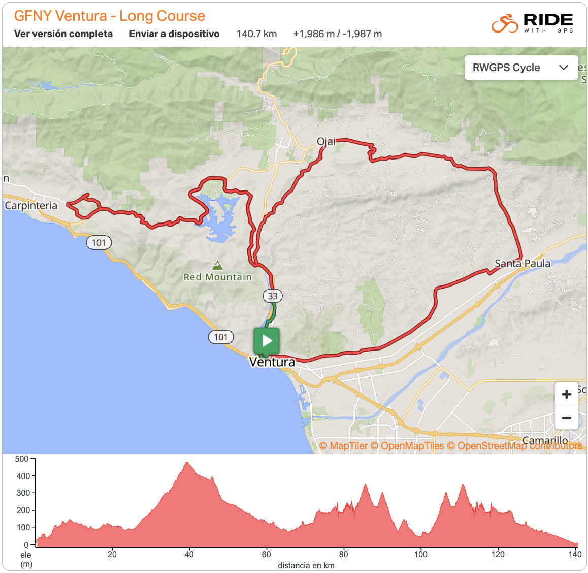
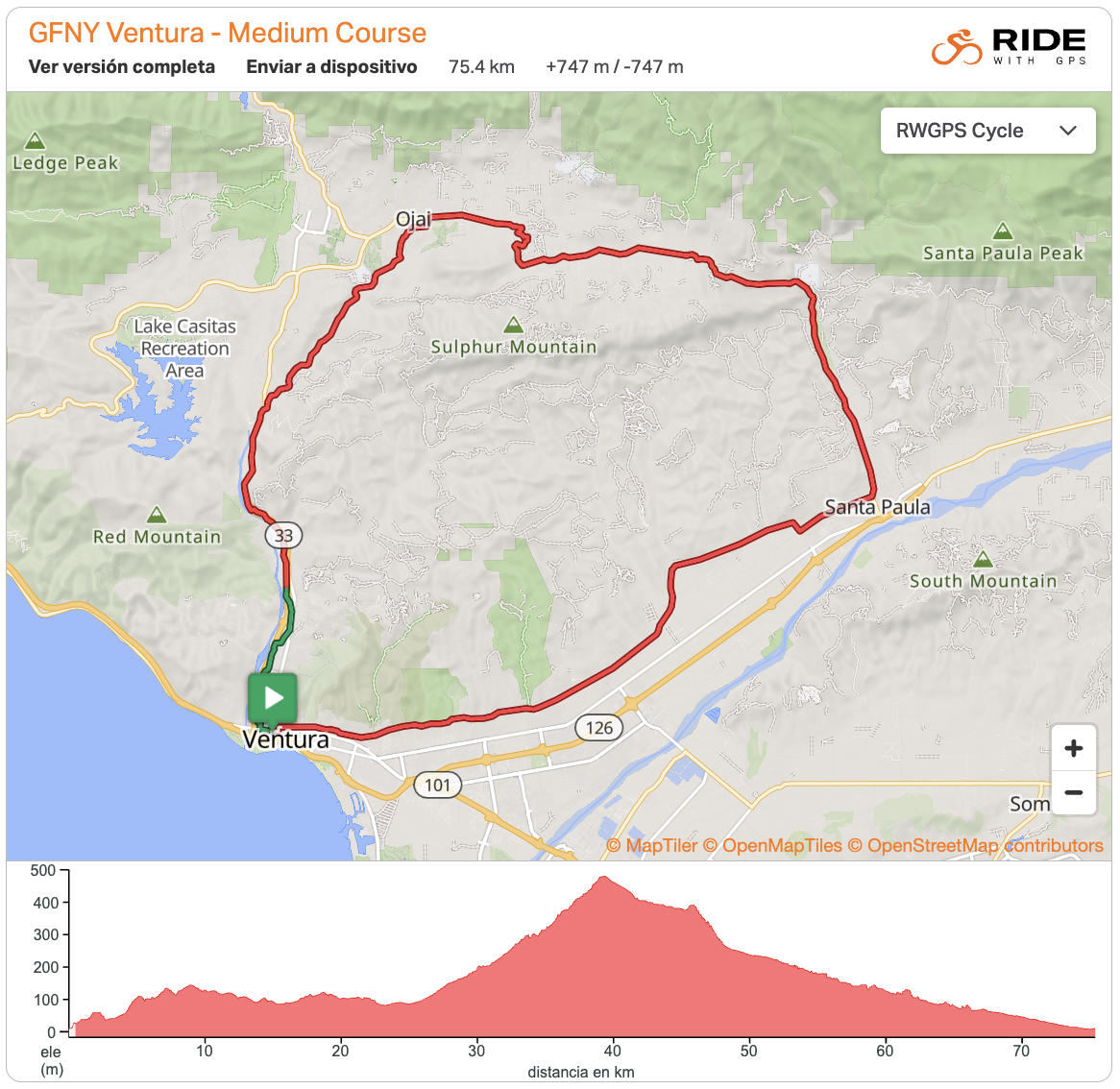
The Course
The race headquarters, packet pickup, start and celebratory finish all take place at Mission Park, located in the heart of the lively Downtown Ventura, which boasts 65 restaurants and over 110 stores.
From Mission Park, you will take on a majestic loop, which will take you through the cities of Ventura, Santa Paula and Ojai, as well as through scenic and open areas of Ventura County. The first part of the loop is slightly undulating, until you reach Santa Paula. From Santa Paula, you’ll take on the day’s longest climb, Dennison Grade, which is 8-miles long with 1300ft of climbing and a 2.9% avg and 7% max incline. The descent that follows is gentle and enjoyable: 16 miles long and a -1.9% avg. Breeze through the Ojai Valley, which is bordered to the north by Los Padres National Forest and the Topatopa Mountains and enjoy the breathtaking views of canyons, mountains and nature.
At the end of the descent, medium route riders will continue on back to Ventura, while the long route riders will turn right and head to a 40-mile out-and back section to Carpinteria in Santa Barbara County. From the course split, it’s just 2 miles to go until the Timing Finish.
On the out-and-back segment, the long route riders will pass by the beautiful Lake Casitas before climbing Casitas Pass from the east side. As you descend along the winding road from the top of the pass, you will climb two counter-climbs before making the loop turn in the city of Carpinteria. From here, you’ll face the last challenge of the day: Casitas Pass from the Carpinteria side, which is 5.5 miles long and 1250ft of climbing with 3.2% avg and 11% max incline. The last 15 miles from the top of Casitas Pass are a net downhill, but include some rolling hills.
The Timing Finish for both the medium and long route takes place on Crooked Palm Road. There will be a refreshment station with water, electrolyte drink, soda, ice and basic snacks. From here, you’ll ride 3 miles on the peaceful bike trail and enjoy a comfortable -1% decline that leads you directly back to Downtown Ventura, less than half a mile from Mission Park.
Back at Mission Park, your Celebratory Finish Line awaits you, and the big photo op moment back where you started the day. You will get your finisher medal at the Celebratory Finish Line at Mission Park. The festival area welcomes athletes and supporters to enjoy the music, the post-race meal, relaxation, the awards ceremony and all post-race festivities.
Long Route – 140.7 km / 1986 m+
Medium Route – 75.4 km / 747 m+
About Ventura
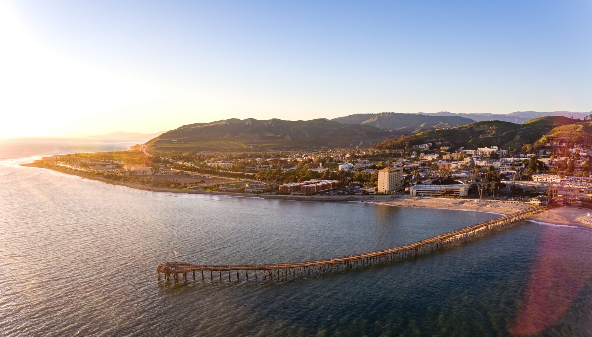
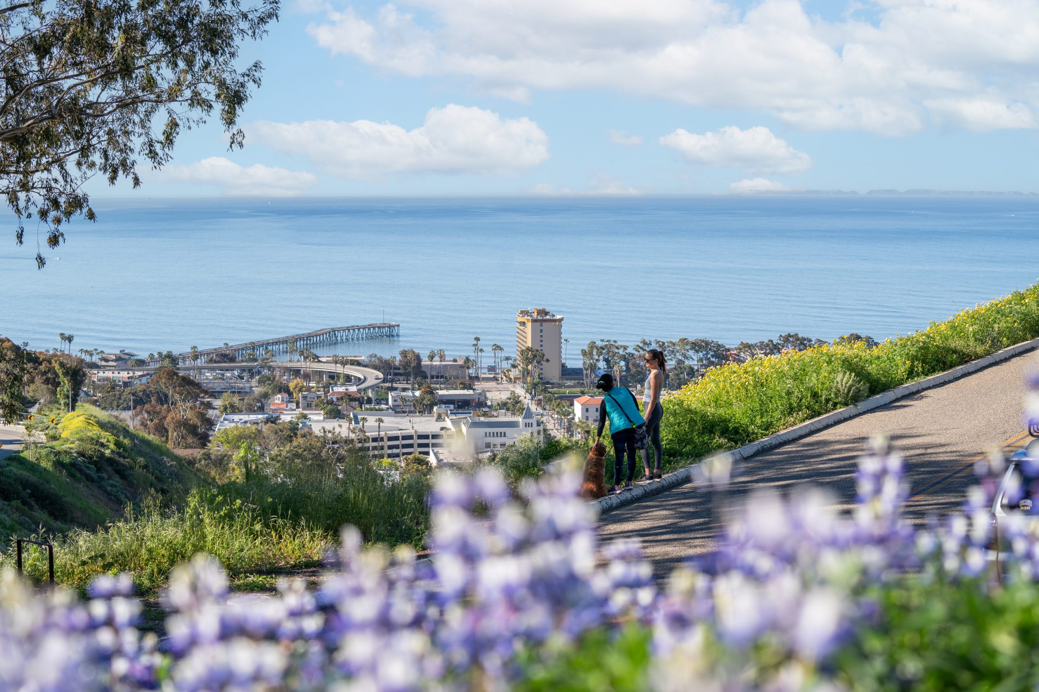
The city of Ventura, officially known as San Buenaventura, is a coastal gem located along the iconic Pacific Coast Highway, about an hour north of Los Angeles. It is famously home to the San Buenaventura Mission, founded in 1782, which served as the historic heart around which the city grew. Today, Ventura is celebrated for its laid-back California vibe, stunning Mediterranean climate, and its deep connection to the ocean, anchored by the historic Ventura Pier — one of the longest wooden piers in the state.
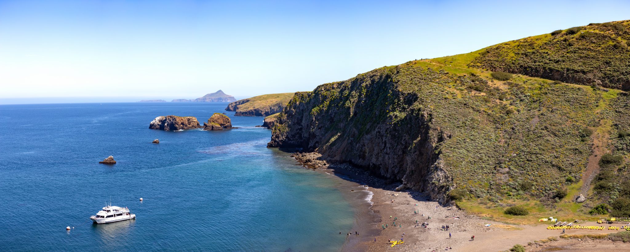
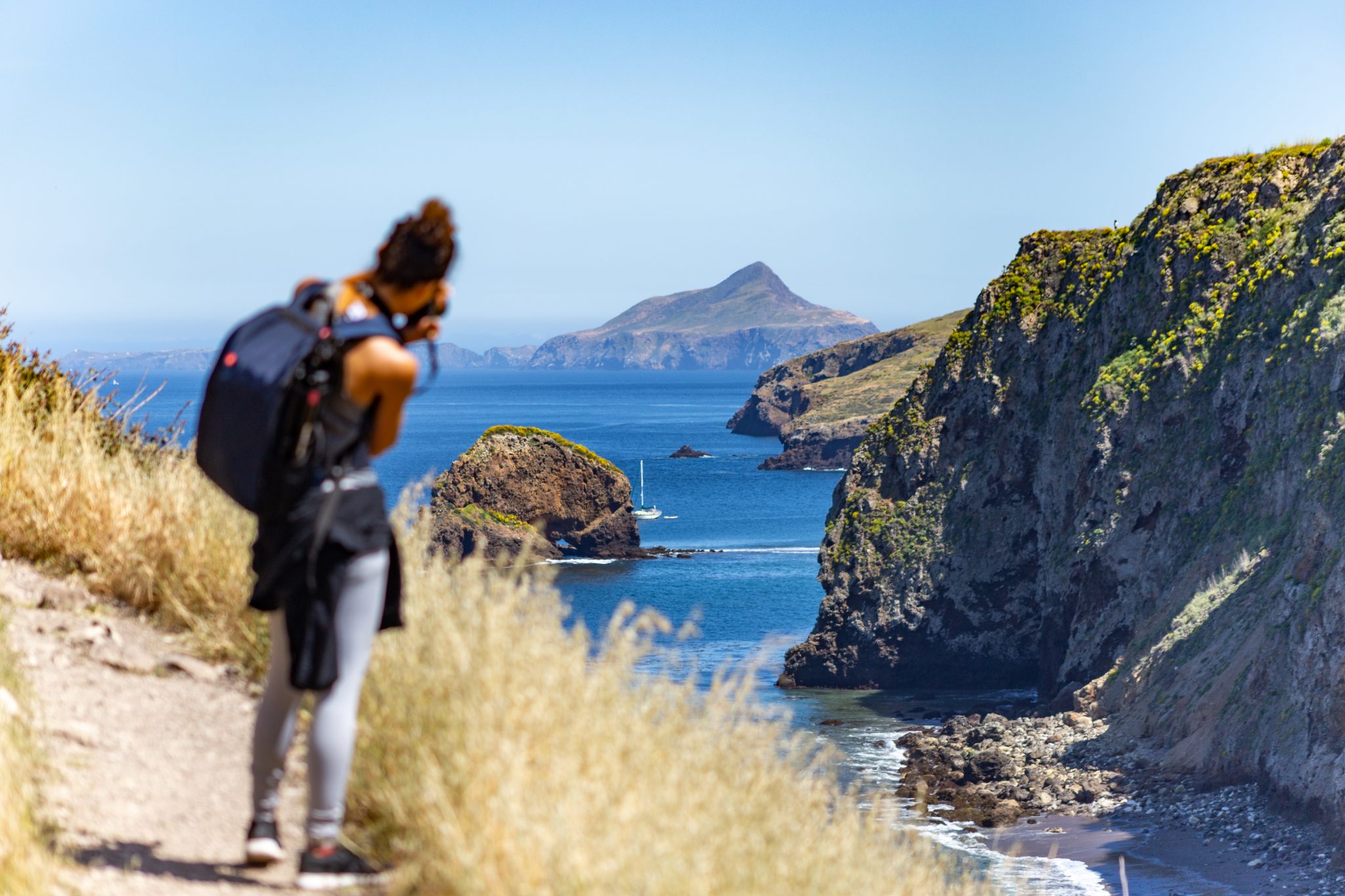
Ventura serves as the primary gateway to the Channel Islands National Park, often called the “Galapagos of North America.” From the Ventura Harbor, visitors can embark on journeys to these remote islands, which host unique species and rugged landscapes. The city’s downtown is a walkable blend of vintage charm and modern culture, featuring beautifully preserved Victorian and Spanish Revival architecture, local boutiques, and a thriving farm-to-table culinary scene.
For cyclists, Ventura is a true paradise. It offers a diverse terrain that ranges from breezy coastal paths like the Rincon Bike Trail to the challenging climbs of the Los Padres National Forest and the nearby Ojai Valley. With its wide-open roads, breathtaking ocean views, and a community that lives outdoors, Ventura provides an epic backdrop for GFNY Ventura, making it an unforgettable destination for athletes and their families alike.
Getting Here
By plane:
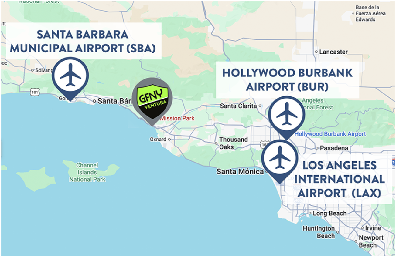
Ventura is conveniently located near three main airports, offering different options depending on your travel logistics:
- Los Angeles International (LAX): 70 miles south, this is the best option for international flights, offering great flexibility and extensive flight schedule for the majority of the airlines.
- Burbank Hollywood Airport (BUR): 60 miles southeast, a convenient mid-sized alternative. Flights operated mainly by Southwest, Alaska Air, a handful of flights from American Airlines, United, Delta and Jetblue. A traveler favorite, offering a convenient and fast alternative for your trip. Best of all, it has a direct connection to Pacific Surfliner and Metrolink trains, which go straight to downtown Ventura without the need for a rental car.
- Santa Barbara Airport (SBA): 37 miles north, the closest and most stress-free option. Flights operated mainly by Southwest, Alaska Air, a handful of flights from American Airlines, United and Delta. The Goleta Amtrak station is just a 5 minute Uber ride away. From there, the Pacific Surfliner train goes straight to downtown Ventura. It’s a very easy and beautiful trip next to the ocean.
By train:
The Amtrak Pacific Surfliner stops right in Downtown Ventura, offering one of the most beautiful train rides in the U.S. along the Pacific coast. It connects Ventura to San Diego, Los Angeles, and Santa Barbara. The train is bike friendly, so you can easily bring your equipment and enjoy the ocean view along the way. Just remember to book your bike reservation early, as spaces are limited and can sell out quickly, especially if traveling on a weekend.
By car:
Ventura is easily reached via Highway 101 (the Ventura Highway).
- From Los Angeles: Approx. 1 to 1.5 hours.
- From Santa Barbara: Approx. 35 minutes.
- For a scenic arrival, take the Pacific Coast Highway (Highway 1) for breathtaking ocean views.
Tags: Europe, LatAm, North America